Advertisement

A polar blast originating in Antarctica is headed towards southeastern Australia, set to freeze millions of Aussies. Weatherzone meteorologist Anthony Sharwood warned the cold front is likely to hit on Monday.

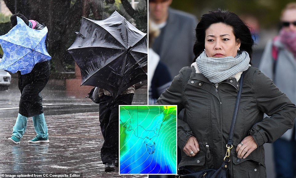
The system is expected to deliver rain, wild winds and potentially heavy snowfalls to alpine regions in Tasmania , Victoria, southern NSW and the ACT. While those in Australia’s southeast may feel prepared having shivered through a cold front last weekend, which delivered centimeters of snow to ski resorts, Mr Sharwood warned next week’s will be more intense. Pictured: temperature forecast for Tuesday.

‘The coming system looks to be stronger, colder, longer-lasting and wetter with the potential for heavy precipitation in a broad arc extending roughly from Adelaide to the ACT,’ he said. ‘This is the sort of cold front that snow lovers dream about in midwinter, let alone in May.

‘The chart above shows how frigid air is expected to push northwards from well south of Tasmania early next week. The cold air should reach SE Australia on Monday along with plenty of moisture.’ Snow could fall down to 400m in Tasmania’s mountains. Pictured: temperature forecast for Tasmania on Tuesday

‘In terms of systems of this calibre in May, the predicted set-up is reminiscent of the famous May 28-30 cold outbreak way back in the year 2000, when a meter of snow fell at the ski resorts and an NRL game at Canberra Stadium was played on a field that was white with settled snow,’ Mr Sharwood said.

‘That’s not to suggest that the system will be quite that cold, or that snow will settle across Canberra, but brief snow flurries down as low as Canberra’s elevation – around 600m – appear possible at this stage, with the snow level closer to 400m in Tasmania.’ The cold front is good news for ski lovers with the system to provide a half-meter of snow just in time for ski season.

‘That’s assuming there’s no major rain event between this system and the season opening on Saturday, June 7,’ Mr Sharwood said. Significant rain is forecast for large parts of Victoria and southern SA. ‘Estimating precise rainfall totals a few days out from a weather event is difficult to do with confidence, however widespread falls of at least 10mm or more are likely in the areas mentioned,’ Mr Sharwood said.

‘While this system is highly unlikely to be a drought-breaker, many locations will see their heaviest falls to date in 2025.’ Strong and potentially damaging winds are also set to affect alpine areas and exposed coastal weather stations in Victoria and Tasmania as the arctic air mass pushes northward.

‘It’s also worth mentioning that eastern NSW will be vulnerable to falling trees due to loose soil from the recent extremely heavy rain and historic flooding,’ Mr Sharwood said. ‘While the NSW coast usually sees minimal rainfall from southwesterly systems like this one, it generally doesn’t miss the strong winds.’
This article was originally published by a www.dailymail.co.uk . Read the Original article here. .


