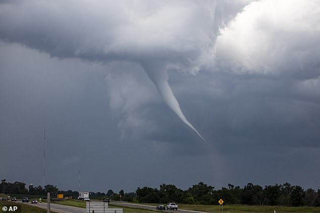
A potentially violent storm is headed into the Pacific Northwest today that could bring life-threatening tornadoes to states that rarely see them.
Idaho, Oregon, and Washington state have been placed under severe weather warning as of Wednesday, with Seattle, Tacoma, Vancouver and Portland under the highest threat.
Due to unseasonably warm temperatures that are 10 to 20 degrees hotter than normal, meteorologists said there is a chance for these states to see ‘severe and violent’ thunderstorms into Thursday.
These storms are expected to be strong enough to produce tornadoes tonight, particularly in areas west of the Cascade mountain range in Washington and Oregon.
Typically, both of these states only see two to three minor tornadoes a year, causing very little damage and few injuries.
Forecasters have also warned that the region will likely see heavy rain, hail, and wind gusts reaching 60 mph.
AccuWeather meteorologists said that the powerful gusts will be strong enough to snap tree limbs and topple poorly rooted trees – presenting even more danger for anyone outdoors.
A similar burst of severe weather in the central US this month killed at least 40 people across several states.

Meteorologists warn that Idaho, Oregon, and Washington may all see isolated pockets of tornadoes Wednesday night as a severe thunderstorm moves in (Stock)

Forecasters predict that the storm will move in Wednesday afternoon and bring heavy rain, hail, and dangerous wind gusts to the region through Thursday
AccuWeather meteorologist Grady Gilman warned: ‘As the upper levels of the atmosphere cool while the warmth near the ground peaks, some of the thunderstorms can become severe and violent.’
Overall, the tornado risk Wednesday night is lower than it was in the central states two weeks ago, but Gilman cautioned that meteorologists still can’t rule out a dangerous twister touching down in these three states.
Power outages could also pop up during the storm, which will bring drenching rain to northern California as well.
The heaviest rain is set to move in on Thursday and Friday after the severe thunderstorms pass.
Forecasters are projecting two to four inches of rain along the Pacific Coast as residents try to clean up the damage from Wednesday’s storm system.
However, there could be up to eight inches of rainfall in certain areas, with some of that changing over to snow in parts of Idaho and western Oregon and Washington.
‘Unlike most storms thus far this year, this storm will have a significant amount of warm air on its front side,’ the AccuWeather team explained.
‘The warmth will result in snow levels well above the passes for most of the storm,’ they added.
Forecasters warned that all of this precipitation may also trigger flash flooding and mudslides along the western slopes of the Cascade mountain range – which runs all the way into California.

Meteorologists explained that extremely warm temperatures for March could fuel severe thunderstorms in the Pacific Northwest this week
Meteorologists added that all of this bad weather is being fueled by temperatures climbing into the 70s throughout the Northwest on Wednesday.
This unseasonably warm spring actually broke records in Washington and Oregon on Tuesday.
In Portland, Oregon, it reportedly reached 80°F in the afternoon – smashing the local record dating back to 1966 (74°F).
Temperatures in Seattle and Tacoma, Washington were also at or near record-highs for late March.
Gilman warned that another Pacific Coast storm is already on AccuWeather’s radar for next week.
Forecasters believe it will be ‘just as dynamic’ as Wednesday’s thunderstorms and tornado threat, however, it will likely strike further south – in San Francisco starting next Tuesday.
The National Oceanic and Atmospheric Administration (NOAA) has already been warning that Americans should prepare for extreme winter weather starting in mid-March.
Experts said a ‘polar vortex collapse’ will likely plunge the US back into the frigid weather much of the country suffered through in February.
This weather phenomenon is expected to bring even more winter weather and extremely cold temperatures later this month and into the spring, possibly leading to widespread travel disruptions for millions.
A polar vortex collapse, also called sudden stratospheric warming, is an event that causes cold Arctic air to bleed south – bringing icy conditions to the US, Canada, the United Kingdom, and Europe.
This article was originally published by a www.dailymail.co.uk . Read the Original article here. .


